Current Population as of 2015: 613 - declining
Incorporation Type : Home Rule Borough
Borough Located In : City & Borough of Yakutat
School District : Yakutat School District
Regional Native Corporation : Sealaska Corporation
Located at : 139° 44' W Longitude - 59° 33' N Latitude
Land Area : 5,875.0 Square Miles
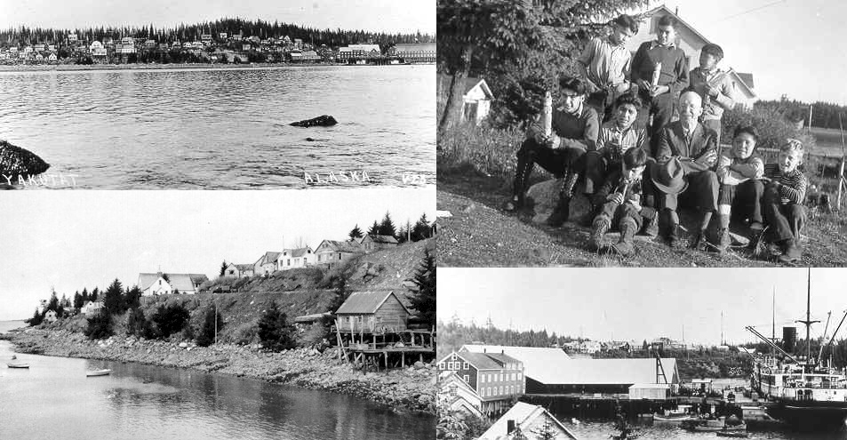
Yakutat Location Description
Yakutat is isolated among the lowlands along the Gulf of Alaska, 212 miles northwest of Juneau and 225 miles southeast of Cordova. It is at the mouth of Yakutat Bay. The Hubbard and Malaspina Glaciers are nearby.
Yakutat History
Yakutat has a diverse cultural history. The original settlers are believed to have been Eyak-speaking people from the Copper River area who were conquered by the Tlingits. Yakutat means "the place where the canoes rest." In the 18th and 19th centuries, English, French, Spanish and Russian explorers came to the region. Fur traders were attracted to the region's sea otters. The Russian-American Co. built a fort in Yakutat in 1805, to harvest sea otter pelts. Because the Russians would not allow local Tlingits access to their traditional fisheries, a Tlingit war party attacked and destroyed the post. In 1884, the Alaska Commercial Co. opened a store in Yakutat. By 1886, the black sand beaches in the area were being mined for gold. In 1889 the Swedish Free Mission Church had opened a school and sawmill in the area. A cannery, sawmill, store and railroad were constructed beginning in 1903 by the Stimson Lumber Co. Most residents moved to the current site of Yakutat to be closer to this cannery, which operated through 1970. During World War II, a large aviation garrison and paved runway were constructed. Troops were withdrawn after the war, but the runway is still in use.
Yakutat Culture
The area maintains a traditional Tlingit culture with influences from the original Eyaks, as well as Russian, English and American traders and miners. Fishing and subsistence activities are prevalent.
TLINGIT CARVING
The Tlingit people are artistic by nature and some people would argue that their fine sense of workmanship and design is best exemplified through the medium of carving. Most Tlingit objects were carved from wood, the most readily available and highly useable substance. Other materials such as horn, copper and later silver were also decorated with carved figures.
The unique design elements or patterns used by traditional Tlingit carvers belong to what has become known as the Northwest Coast Indian style. This style, quite easily recognizable, portrayed creatures from the natural world in varying degrees of realism. Often they were split or fragmented with eyes, joints, fins, feathers or some other easily recognizable feature delineated with broad black form lines. Traditional colors were a green-blue and red. The Northwest Coast Indian style, present from Yakutat to Washington State has subtle stylistic differences in each region. Tlingit motifs may be classified as Northern Northwest Coast Indian art, a distinct style seen from approximately Bella Coola (British Columbia) to Yakutat Bay, Alaska.
At one time Tlingit carving was considered important by the outside world for its ethnological value. However, at the San Francisco Exposition of 1939, and later at a 1941 exhibit at the Museum of Modern Art in New York City, Tlingit carving was displayed as art. Now it is a widely acknowledged art form highly prized by art lovers worldwide. Many modem Tlingit artists continue to carve in the traditional style.
CARVING TOOLS
Adzes - came in a variety of sizes. Before the introduction of iron they were made of stone. The adze was used to hew out a form.
Stone axes - were used for splitting wood.
Drills - were used for making holes by rotating the point In a piece of wood. The holes were then used for sewing or tying parts of an object together.
Carving knives - were made of stone, bone or shell before the introduction of metal. They were many shapes and sizes and were made to fit the carver's hand and purpose. Carving knives were used for different mediums including wood and metals.
CARVING MATERIALS
Wood - Both red and yellow cedar were highly prized for carving dugout canoes and totemic poles. It split along a straight grain and was thereby valuable for planks. Cottonwood was used for making small dugout canoes. Since it did not transfer taste to food, alder was the preferred wood for carving dishes and utensils. Local birch is prized by many contemporary carvers for its lovely grain.
Horn - Both goat and sheep horn were carved, usually into handsome feasting spoons.
Metals - Gold and silver coins were hammered into shapes and carved. Copper from the interior was also used.
CARVED OBJECTS
Tlingit carvers concentrated their most decorative efforts on ceremonial and shamanic art. Staffs, masks and rattles were decorated for potlatch songs and dances and for other rituals such as healing conducted by the shaman. The most lavishly carved eating utensils and bowls were saved for potlatches while those used for everyday meals were simply decorated. Carved boxes stored food supplies, ceremonial clothing, or were used for cooking by dropping hot stones into a box filled with water. Huge screens, used to divide the living quarters within a house, were ornately carved, often with a family crest. The museum frequently receives questions about totemic poles and dugout canoes.
Houseposts and Totem poles - Figures, or totems, carved on totem poles are comparable to family crests and are used to tell a story, legend, event, tradition, etc. The totemic symbols are usually animal -a bear, eagle or killer whale for example. Their significance comes from some mythical time when they affected the destiny of a groups ancestors. Perhaps an early clan was aided by some creature to ward off starvation or make an important discovery like fire.
To understand the meaning of a carved pole, it would be necessary to know what those who commissioned it intended it to mean. Sometimes the story has been passed down correctly to the present generation and sometimes it has been altered or lost.
The northern Tlingit people confined their crest poles mainly to houseposts, the poles supporting the main or entrance beams of a house.
Canoes - Canoes were the major means of transportation for coastal 'Tlingits. Small canoes were made for both men and women, large ocean- going canoes were owned by family groups. Great skill was required to carve a dugout canoe such as the one on exhibit at the museum. First an appropriate tree was selected; cottonwood for a small canoe and red or yellow cedar for a larger one. Red cedar was the favored wood, but it grows mainly in the land of the Haida Indians south of Tlingit territory. The Tlingits traded with the Haidas for the prized large cedar.
The log was first hollowed out with an adze then shaped by a process which involved filling it with water heated to a near boil with hot rocks. Hot steam penetrated the log making it soft and workable. At this point thwarts were forced between the sides, pushing them to the desired shape. The boat was then dried and smoked over a pitch fire which also blackened the wood. In the case of larger canoes, separate pieces were added to form the high prow and stem. Large canoes often had a carved figure on the prow and some were painted with crests and emblems. A waterproof, durable paint was made by mixing minerals, salmon eggs and chewed spruce gum and applied with a bear or porcupine hair brush.
BIBLIOGRAPHY Billman, Esther. Tlingit Bull. Num. I. Sitka: Sheldon Jackson Museum Press. 1975. Halpin, Marjorie M. Totem Poles: An Illustrated Guide. Vancouver: University of British Columbia Press. 1981. Holm, Bill. Northwest Coast Indian Art: An Analysis of Form. Seattle: University of Washington Press. 1965. Jonaitis, Aldona. Art of the Northern Tlingit. Seattle: University of Washington Press. 1986. Krause , Aurel. The Tlingit Indians. Translator: Gunther Erna, 1956. Seattle: University of Washington Press. 1885. Barbara Waterbury, 1987
Yakutat Economy
Yakutat's economy is dependent on fishing, fish processing and government. 174 residents hold commercial fishing permits. A cold storage plant is the major private employer. Recreational fishing opportunities, both saltwater and freshwater fishing in the Situk River, are world-class. Most residents depend on subsistence hunting and fishing. Salmon, trout, shellfish, deer, moose, bear and goats are harvested. The soil is not suitable for agricultural activities.
Yakutat Facilities
Water is derived from four wells, is treated and piped to most homes in the community. Piped sewage receives primary treatment; a secondary treatment facility is nearing completion. Approximately 90% of all households are plumbed. A private firm collects refuse, and the City operates the landfill. Electricity is provided by Yakutat Power, Inc., which has provided a contract to the Tlingit-Haida Regional Electric Authority to provide power. Four diesel-fueled generators are operated in Yakutat. The company is interested in exploring hydroelectric potential at Chicago Harbor.
Yakutat Transportation
There are scheduled jet flights, air taxis and float plane services to Yakutat. The State owns two jet-certified runways; one is 7,813' of concrete, the other is 7,750' of asphalt. A seaplane base is available. The U.S. Forest Service also owns six airstrips in the vicinity. The Borough operates the State-owned boat harbor and the Ocean Cape dock. Monti Bay is the only sheltered deep water port in the Gulf of Alaska. Barges deliver goods monthly during the winter, and more frequently in summer. The new State Ferry Kennicott will begin serving Yakutat in July 1998. However, severe seas in the Gulf of Alaska during winter months will restrict the ferry service to summers only.
Yakutat Climate
Yakutat has a maritime climate characterized by relatively mild, often rainy weather. Average summer temperatures range from 42 to 60; winter temperatures average 17 to 39. Yakutat receives some of the heaviest precipitation in the state, averaging 132 inches, including 219 inches of snowfall.
Information COURTESY OF Alaska Department of Community & Regional Affairs
YAKUTAT
The Yakutat Ranger District consists of approximately 1.2 million acres of National Forest land and is located in the northern-most part of Southeast Alaska. The City of Yakutat is a village of approximately 800 people, approximately 60% of which are Alaska Natives. Commercial, sport, and subsistence fisheries are the biggest sector of the local economy. Timber harvesting is also active in Yakutat, but perhaps the greatest potential for growth lies in the commercial fisheries, recreation and tourism industries.
The climate in the Yakutat area is rather wet and relatively mild. Flooding, however, is quite rare because the soil is extremely porous and absorbs much of the moisture. Yakutat experiences frequent overcast and cloudy days due to storms and weather conditions of the Gulf Coast backing up against the large mountains of the Yakutat area.
SERVICES IN YAKUTAT
The Yakutat community provides most necessary services for visitors. There are several small businesses offering a variety of goods and services. Most of these are operated out of residents' homes. The lodges, as well as other visitor services, operate at or beyond capacity throughout most of the summer season. During the winter months, however, many of the services either close down or operate on limited hours.
Yakutat operates a K-12 school system and numerous state and federally run agencies maintain offices in Yakutat. Emergency evacuation to hospitals in Anchorage or Juneau is available through air ambulances and/or Alaska Airlines jet service.
INFORMATION CENTERS
YAKUTAT
National Park Service
Yakutat District Office
Glacier Bay NAT'L Park & Preserve
P.O. Box 137
Yakutat, Alaska 99689
907/784-3295
Tongass National Forest ![]()
U.S. Forest Service
Yakutat Ranger District
Tongass National Forest
P.O. Box 327
Yakutat, AK 99689
(907) 784-3359
VISITOR ATTRACTIONS
YAKUTAT GLACIERS
There are numerous glaciers and glacial ice fields surrounding the Yakutat area. The Malaspina Glacier, located across Yakutat Bay, is larger than the state of Rhode Island. It stretches along the Gulf Coast for about 50 miles and reaches inland about 30 miles. It is visible on a clear day from Ocean Cape. The Yakutat Glacier is one of the largest glaciers in the forelands and it feeds into Harlequin Lake and forms the headwaters of Dangerous River. This lake, river, and glacier are accessible via Forest Highway 10.
Perhaps the best known glacier in the Yakutat area is Hubbard Glacier. The persistent advance of this glacier since about 1895 has generally accelerated during the 20th century and has led to its great notoriety.
The advancing ice and push moraine blocked the entrance to Russell Fiord for the first time this century near the end of May 1986. The level of water in the Fiord began to rise immediately because of fresh-water inflow from Hubbard Glacier itself, as well as other glaciers and non-glacier areas surrounding the fiord. This dam caused Russell Fiord to become Russell Lake, creating the largest glacial dammed lake in the world. The dam, however, gave way between 11:00 p.m. and 12 midnight on October 7, 1986. The outburst flood swept away the ice and moraine dam, as well as most of the loose sediments that had nearly connected Osier Island with the mainland. Island with the mainland.
If the dam had not failed, water would have eventually over flown into the Situk River, causing it to increase by approximately 12-fold. This increase would dramatically alter the fisheries and recreational characteristics of the Situk River, thus greatly impacting the Yakutat economy, salmon fisheries, wildlife, cultural resources, ground water, vegetation, and the area's transportation systems. In spite of this, preliminary estimates indicate that not all effects would be negative in the long run.
During the spring of 1989, a surge in Hubbard Glacier was observed once again. This event was judged to be similar in magnitude to the 1986 event that resulted in the damming of Russell Fiord. The reason the 1989 surge did not result in a closure was that the loose materials forming the protective moraine that reduced calving in 1986 had been washed away by the outburst flood.
Hubbard Glacier is expected to continue its slow advance into Disenchantment Bay and Russell Fiord. At the present rate of advance, the terminus at Sand Dab Passage should have reached Gilbert Point by about 1993. Unpredictable events, however, make such a simple forecast unreliable.
Analysis of recent glacier behavior and current conditions indicates that a closure which eventually results in overflow into the Situk is likely to occur within the next decade. Hubbard Glacier is in the strongly advancing phase of the calving glacier cycle and is likely to continue regardless of climate variations, although the gradual increase in both annual precipitation and temperature recorded at Yakutat since 1950 does favor glacier growth.
A closure is most likely to occur during April, May, and/or June because this is when the seasonal terminus advances are most rapid. A spring closure will, however, be subject to the most rapid water-level rise as both melt and rain runoff fill Russell Fiord. A rapid rise of the lake could outpace the thickening and widening of the dam due to ice flow and thus increase the likelihood of dam failure.
The more time that passes before the next closure, the more likely the closure will last long enough to produce an overflow into the Situk River drainage. As time passes, the general advance of Hubbard Glacier terminus will result in a stronger dam due to the greater thickness of ice. Considering the complex interaction of dam formation and failure processes, it is likely that overflow into the Situk drainage may be episodic at first, as dams form and fail. However, once a stable dam is in place, it is likely to be sustained for many hundreds of years as Hubbard Glacier slowly advances down Disenchantment and Yakutat Bays during the advance phase of the tidal glacier cycle.
There is a small chance that a closure will not occur in the next 10 years, and an even smaller chance that a closure may be forestalled for decades. For instance, it is possible that the advance into Disenchantment Bay will partly bypass Gilbert Point, and a tidal channel will be maintained temporarily. Less likely, the closure could be forestalled by a calving retreat in Hubbard Glacier.
FLORA
The forest surrounding the Yakutat area contains mainly Sitka spruce, with a smaller amount of Western hemlock. Generally, the old-growth forest is extremely dense and impenetrable. The most common plants that are found in the forest include skunk cabbage and devil's club. Some popular berries that can be found in the forest and are accessible near the forest's edge include salmonberries (July-August), blueberries (August-September), and high-bush cranberries (August-September).
Grassy and sandy beach areas are often located at the mouth of river deltas. This region is the best place to find some of the best wild beach strawberries you will find anywhere. They can ripen anywhere from June through early September, depending on the location. Generally speaking, the strawberries on those beaches located on the Gulf of Alaska (Cannon Beach, Lost River Road Beach and Coast Guard Beach) ripen earlier that those found in grassy areas more inland (Upper Dangerous River). Fireweed, lousewort, paintbrush, and lupine can all be found in this region as well.
Muskeg can be found in much of the Yakutat Foreland. Sedges, deer cabbage, heather, Alaska cotton grass, Arctic iris, yellow pond lily, and a type of willow can all be found in this area. The most popular and common berry found in the muskeg area is the Nagoon berry. These can also be found along Upper Dangerous River.
The alpine and sub alpine regions are home to black cottonwood, alder, lupine, and fireweed.
In regard to picking and eating berries, it is advisable to be certain you are familiar with the type of berry you are picking. There are some species of berries in the Yakutat area which are poisonous. A good wild berry guidebook is recommended. Several types of edible mushrooms are also available in the Yakutat area in the fall months. Extreme caution is urged, however, due to the poisonous nature of many mushrooms. Unless you are intimately familiar with mushroom species or are with someone who is, it is wise to avoid the mushrooms altogether.
WILDLIFE
The Yakutat area has numerous species of wildlife, including: moose, mountain goats, black bear, brown bear, the rare glacier bear, Sitka black tail deer, wolves, wolverines, fur bearers, marine animals and birds.
There are many opportunities for viewing wildlife in Yakutat. The best way to find and see wildlife is to look in the right places or habitats and during the right season for the particular species you are looking for, look during the right time of day (early morning or late evening is optimum for most wildlife), and be especially quiet and unobtrusive. Wildlife viewers are urged to minimize the disturbance to the wildlife and any other wildlife viewers, avoid dangerous wildlife, and observe any "no trespassing" signs.
Moose are often seen in clear-cuts during snow-free months and in old growth forests and coastal wetlands all year round. They can also be seen in muskegs with calves during May through June. Spring and summer often find them in riparian areas, while summer and early fall may lead them to alpine tundra.
Mountain Goats are usually found on rocky cliffs in alpine tundra and on steep mountain sides near glaciers and ice fields. They are also found sometimes in old growth forests.
Wolves are usually very difficult to spot due to their quickness, keen senses and ability to hide. They can be found in clear-cuts, old growth forests, muskeg, alpine tundra and riparian habitats. Binoculars overlooking alpine tundra are the recommended way of spotting a wolf.
Black and Brown Bears can be seen in the spring on sub alpine mountain slopes and coastal marshes. In the summer and fall, they are most often spotted around berry patches and salmon spawning streams. They have also been seen occasionally in clear-cut patches, muskeg areas, and old growth forests. Brown bears are more often spotted around the Yakutat area than black bears due to their large population.
Glacier Bears, also known as Blue Bears, are found in the Yakutat area. These bears are extremely rare, but the Yakutat District has the highest population anywhere in the world. They are part of the American Black Bear species and are found among groups of black bears. A black bear can have a glacier bear color phase cub and visa versa. The odd coloring is due to genetics and works much the same way that eye color genetics work in human beings.
There are quite a few varieties of fur-bearing animals in and around the Yakutat area. Weasels, martens and wolverines are often spotted in alpine tundra, old growth forests, muskegs, and riparian habitats. Mink may also be seen in muskegs, riparian habitats and coastal wetlands. River otters are often found along lakes, rivers, and coastal wetlands. Lynx generally reside in riparian habitats, and snowshoe hares are occasionally spotted near rivers, lakes, muskegs and old growth forests.
Several types of marine animals are found along the shores of Yakutat and the Gulf of Alaska coastline. Some of these include sea lions, seals, whales and porpoises. There are many different types of whales in this area, some which are visible near Yakutat occasionally, and some which swim further out in the Gulf of Alaska. Included in this list is the gray whale, blue whale (very few), minke whale, humpback whale, sperm whale, and orca. The best time to view whales is during the summer months. Harbor seals are also sometimes found near glaciers and glacial waterways, such as Russell Fiord.
There are many varieties of rodents in the Yakutat area. The alpine tundra is home to marmots, squirrels, and voles. Squirrels may also be seen in old growth forests and riparian habitats. Beavers have often been seen near lakes, rivers and riparian habitats. Many varieties of voles and shrews can be spotted in almost any habitat, with the exception of glaciers, ice fields, and coastal waters. Muskrats, lemmings, and mice dwell mainly in the muskeg, and near rivers, lakes and coastal wetlands. Porcupines generally stay within old growth forests. Interestingly enough, little brown bats are also found in old growth forests, as well as riparian habitats.
The Yakutat area abounds with a large variety of birds, many of which are rare in other parts of the world. Several species of sparrows, finches, wood warblers, thrushes, swallows, ptarmigan, owls, terns, gulls, cranes, sandpipers, loons, swans, geese and ducks are found in muskeg areas, river and lake areas, and coastal wetlands during various months of the year. This list of birds is definitely not exhaustive and anyone truly desirous of bird-watching should get a handbook or guide on the specific types of birds and where they can be found. In fact, trumpeter swans are readily visible from the bridge crossing Tawah Creek on Cannon Beach Road during the fall and winter months. These swans are very rare and found in fairly large numbers in the Yakutat District.
Hawks, eagles, falcons, crows and ravens are also found in the Yakutat area--some being more common than others. Bald eagles can be spotted year-round, but especially during the spring, summer and fall months when fish are running in the streams. Look for them near salmon spawning rivers, especially during the late summer and fall. Also watch out for bears in these same places.
AIR TRANSPORTATION
Yakutat is located approximately 200 air miles northwest of Juneau. Scheduled commercial jet service provides the only regular access to Yakutat from the rest of the world. Alaska Airlines provides one flight daily from Juneau and one flight daily from Anchorage. The full instrument landing system and cross runways allow Yakutat to have the best record of not having weather delays of any major airport in the state.
In addition to the two state maintained runways for Alaska Airlines, there are seven airstrips maintained by the Forest Service. These airstrips are located at the Middle Situk, Lower Dangerous, Upper Alsek, and Italio Rivers, East River in Dry Bay, Tannis Mesa and Harlequin Lake.
AIRCRAFT CHARTERS
A single aircharter company "Yakutat Coastal" works out of Yakutat durring the months of May - October

Yakutat Coastal Air (907) 784-3831